Knowing how much sediment has been deposited is really important for carbon monitoring, reporting and verification. Here we tested some cost-effective ways to determine the depth to pre-existing soil after a saltmarsh has been created. The work is published in Estuaries and Coasts.
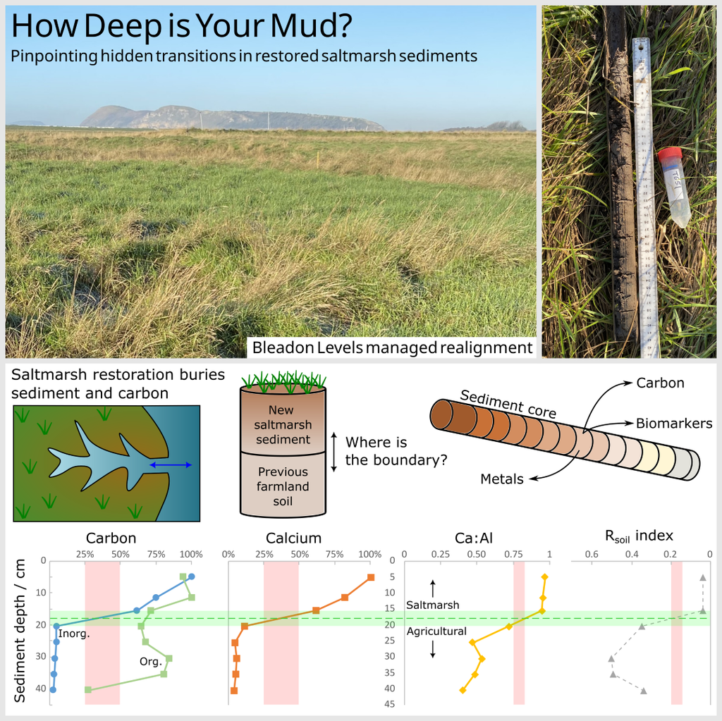
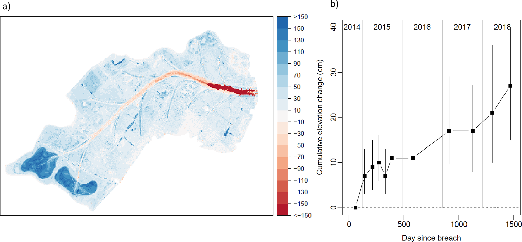
Tidal inundation of saltmarshes can mitigate anthropogenic carbon dioxide emissions by rapidly accumulating carbon-rich sediment, with the potential to sequester this “blue carbon” for thousands of years. The desire to remove atmospheric carbon, alongside increased flood risk from sea-level rise, is driving scientific and financial interest in restoring low-lying land into saltmarshes. Saltmarsh restoration buries agricultural fields with marine or estuarine sediment, yet the transition from agricultural soil to saltmarsh sediment is often difficult to observe in sediment cores. Quantifying sediment accumulation is critical for calculating the carbon benefits of saltmarsh restoration, and a pre-requisite for generating financial returns.
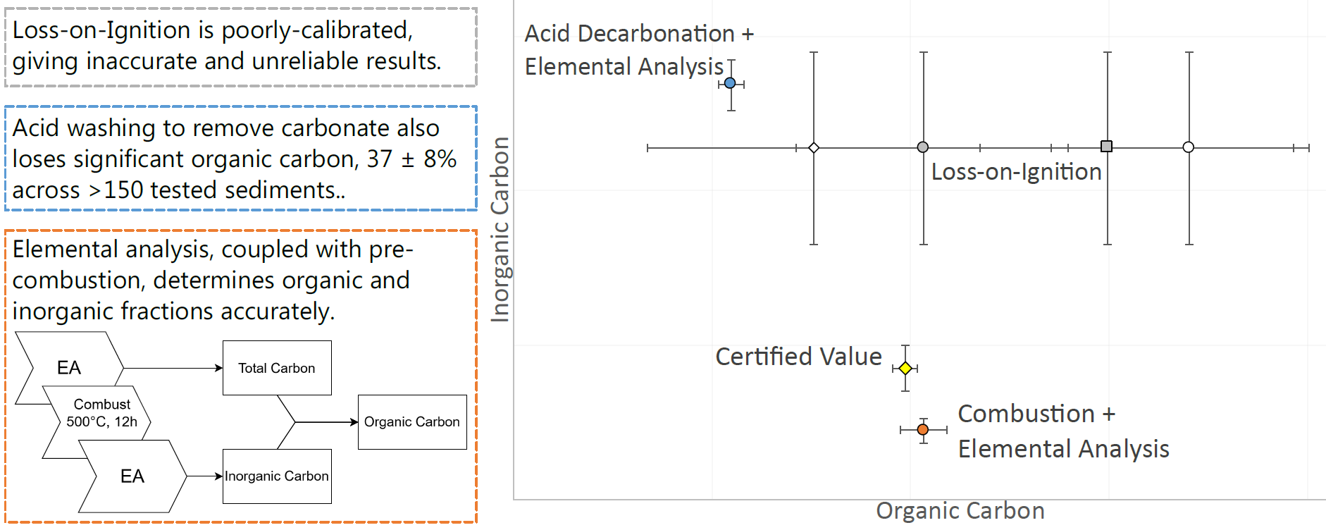
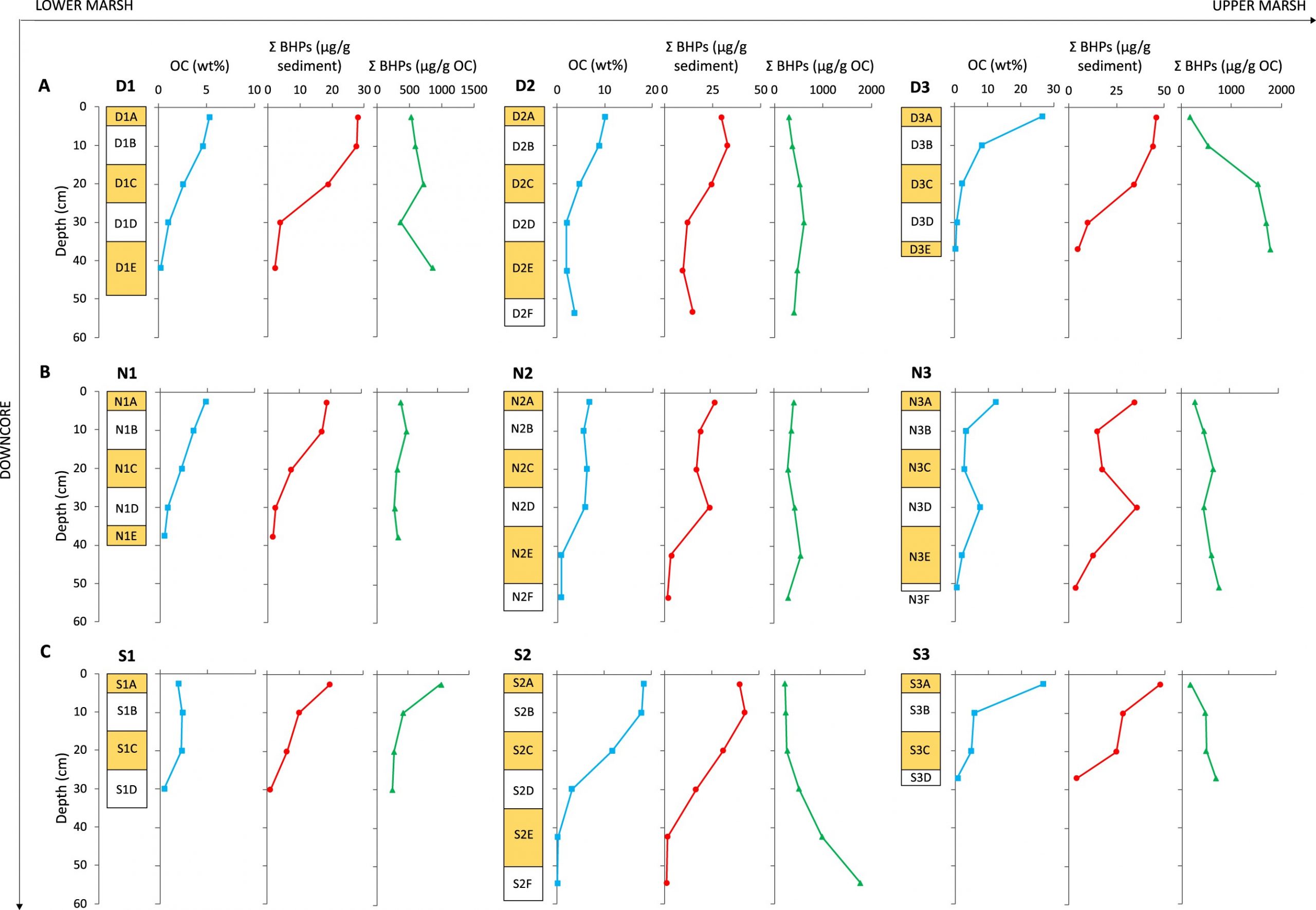
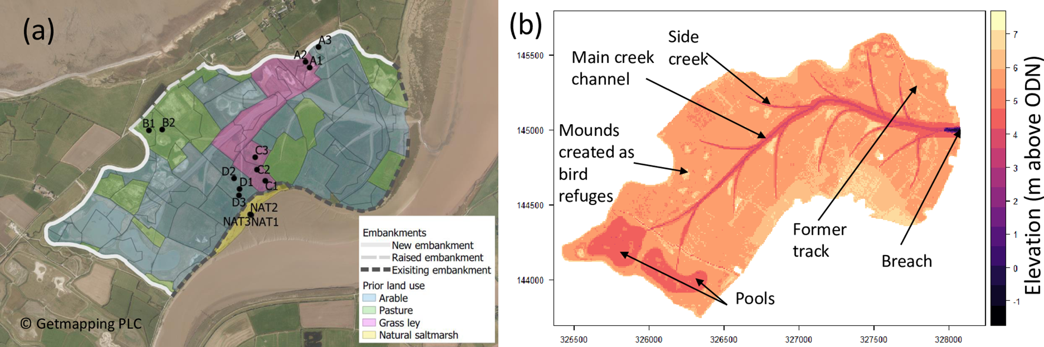
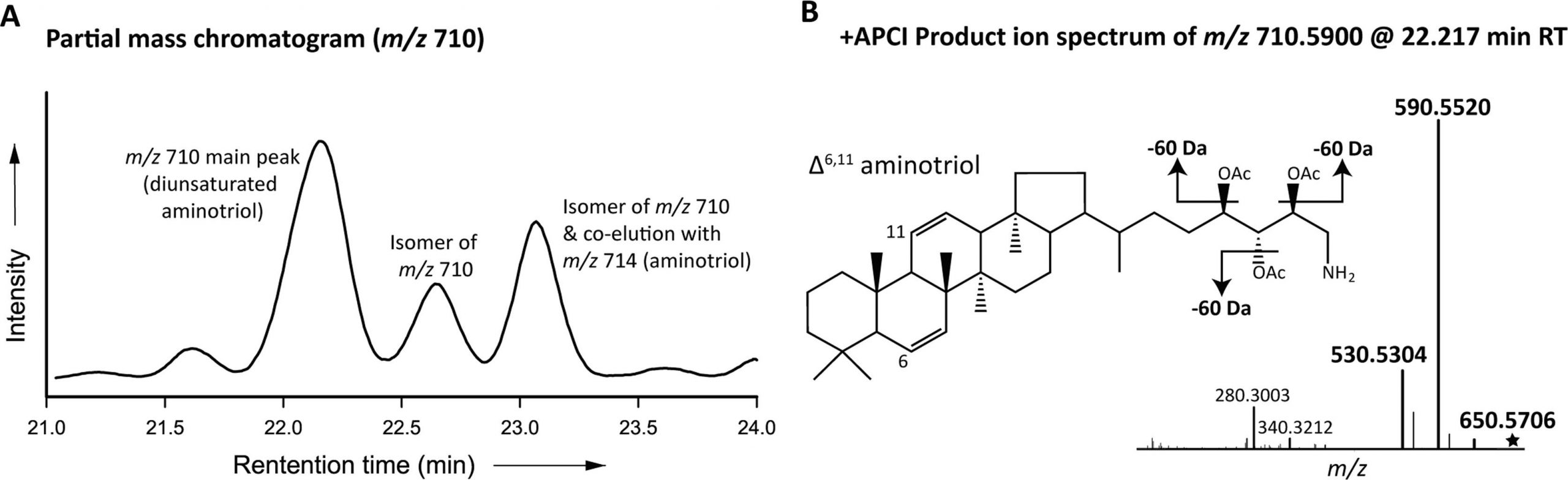
At Bleadon Levels, a restored saltmarsh in Somerset, UK, we tested several methods to determine the transition between agricultural soils and saltmarsh sediments. Calcium (Ca) and inorganic carbon (IC) were significantly more concentrated in the upper parts of cores, interpreted as marine carbonates within saltmarsh sediment deposits. The biomarker-based Rsoil index agreed with Ca and IC data. Organic carbon (OC) measurements did not show matching changes, demonstrating that OC variations with depth do not reliably identify transitions from saltmarsh to agricultural layers. Thus, saltmarsh sediment depth can be determined using relatively simple, cost-effective Ca and IC concentration measurements, and restoration schemes should consider these techniques in their monitoring, reporting and verification procedures.