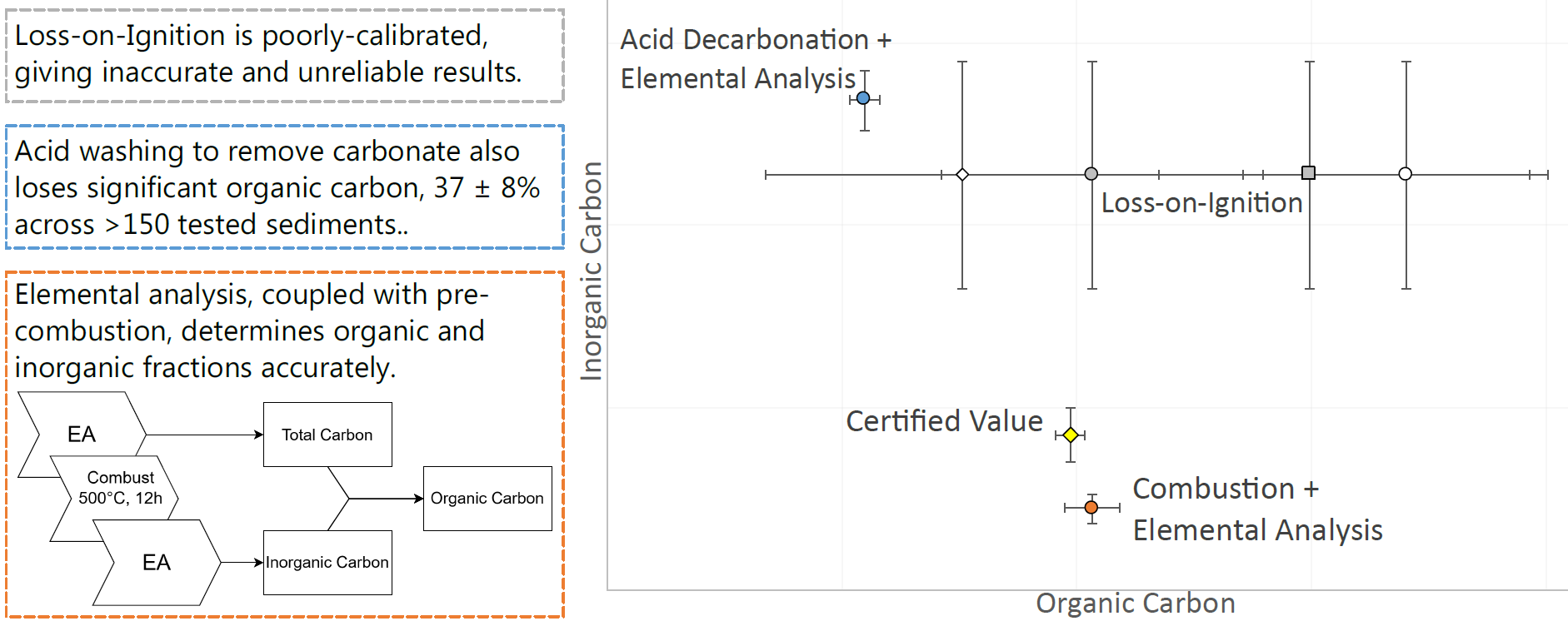
After testing various lab protocols we have a strong preference for coupling accurate and precise instrumental measurements with combustion pre-treatments to isolate and measure organic carbon. This work was published in Organic Geochemistry.
Quick and cost-effective measurements of organic carbon concentration are fundamental for a variety of environmental projects, but not all methods produce reliable results. Poor quality baseline data could compromise an entire study.
Measuring the total amount of carbon in a sediment sample is usually carried out by an elemental analyser, which makes quick, accurate measurements of carbon and nitrogen. However, sediments can contain carbon in a range of forms – plant matter, mineral-bound organics, microbial biomass, shells, carbonate minerals, and more. Sometimes distinguishing all these sources might be criticial, but often the split between organic and inorganic carbon is sufficient, and important since the organic and inorganic carbon cycles are very different.
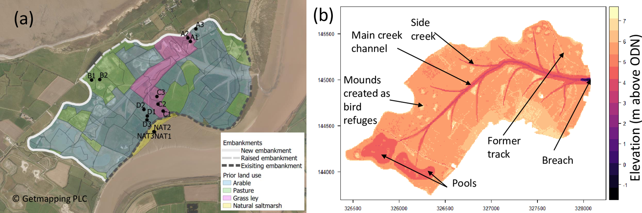
For this study, we investigated three ways of measuring the amount of organic and inorganic carbon in a sediment, with a focus on young materials such as saltmarsh carbon.
- Loss-on-Ignition: Burning the samples a fixed temperatures to combust the organic matter (at about 500 °C) and decompose inorganic carbon (at 800 – 900 °C). Use the change in mass to estimate the amont of carbon present.
- Acid digestion followed by elemental analysis: Removing the inorganic carbon by reacing with acid, and then measuring the remaining organic carbon.
- Combustion followed by elemental analysis: Remove organic carbon in the furnace, measuring the remaining inorganic C, calculating the OC lost.
Perhaps the most important finding should not have been a surprise – Loss-on-Ignition relies on combusting organic matter, but wants to measure organic carbon, therefore a conversion between the two is needed. There are lots of conversions in the literature, and they all produce different results. Our testing showed that some common conversions are out by more than 50%, and we cannot recommend using Loss-on-Ignition for current or future work.
We also showed that using acid to remove inorganic carbon also removed up to 40% of the organic carbon, so we would avoid using this technique unless it’s imperative to measure the organic matter directly, for example in stable carbon isotope analysis.
As a final observation, this work was enhanced by contributions from a cohort of undergraduate student co-authors who generated real-world saltmarsh data. For this, I am very grateful.